Forecasters from the National Weather Service warned of potentially fatal swimming and surfing conditions Tuesday, issuing a High Surf Advisory for portions of Rhode Island and Massachusetts.
Dukes and Nantucket counties in Massachusetts are included in the alert. It starts Tuesday at 8 a.m. and ends Thursday at 8 p.m.
Large breaking waves are predicted to increase daily and peak on Thursday at 8 to 13 feet.
“Inexperienced swimmers should remain out of the water due to life-threatening surf conditions,” forecasters stated.
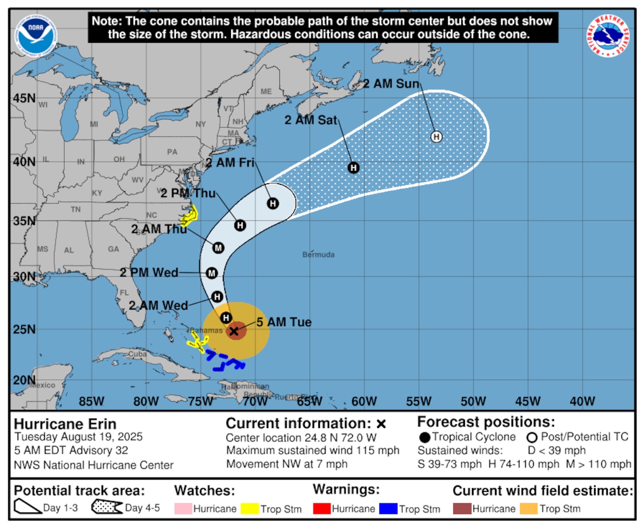
The advisories are issued as Hurricane Erin moves through the area to the southeast this week, causing heavy waves that will eventually make their way to New England. The gradient between the cyclone and a region of high pressure over southern New England may result in gale-force winds over Cape Cod and the Islands on Thursday, in addition to severe surf.
But for the rest of the Bay State, Thursday and Friday will likely be generally breezy before Erin s influence diminishes.
On Monday, Erin brought wind and rain to a portion of the Caribbean. Tropical storm and surge watches were issued for parts of the Outer Banks, but forecasters are confident it will curve north and away from the eastern U.S.
Erin was still a Category 3 storm with maximum sustained winds of 115 mph (185 kph) as of early Tuesday, according to the National storm Center in Miami, albeit it had lost some of its intensity from earlier days. It was traveling northwest at a slower 7 mph (11 kph) and was roughly 770 miles (1,240 km) south-southeast of Cape Hatteras and 675 miles (1,090 km) southwest of Bermuda.
This report included information from the Associated Press.