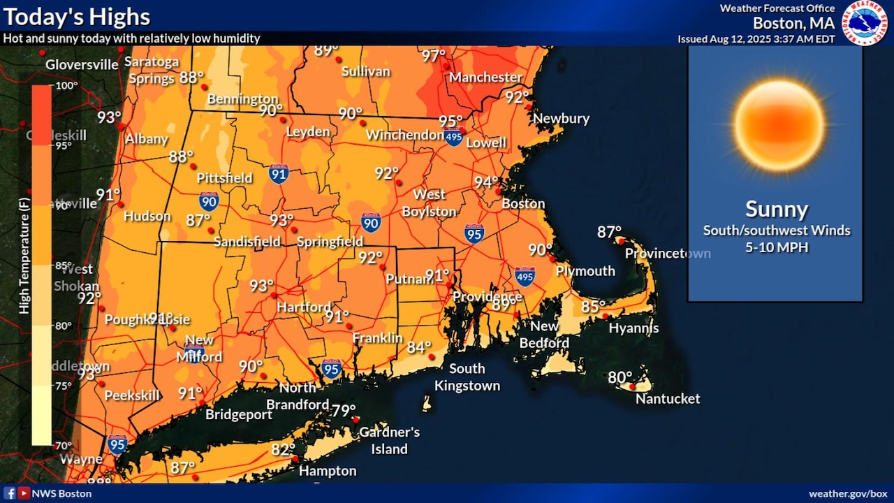
Tuesday is predicted to see temperatures in Massachusetts reach 90 degrees, marking the second consecutive day of extreme heat as the state is engulfed in a heat wave.
In some areas of the Bay State, temperatures might reach 95 degrees, with 93 degrees or higher predicted in Boston, Worcester, and Springfield. However, because of drier air blending in at the surface, Tuesday won’t be nearly as humid as past scorching days this summer. Heat indices, or feel-like temperatures, should therefore continue to hover around the real air temperature.
Heat indices are not expected to clear 95 for two consecutive days this week, according to the National Weather Service forecasts, who have not issued a Heat Advisory.
Wednesday is still hot, with rising dewpoints causing higher humidity levels. In areas of Massachusetts, such as the Merrimack and Connecticut River basins, forecasters predict heat indices to rise to 95 to 100.
Wednesday afternoon or evening might bring much-needed rains to certain areas of the state. However, there won’t be any strong thunderstorms.
Thursday’s weather is still uncertain, with more clouds and the possibility of showers. If not, Thursday is predicted to be a humid day with highs in the mid-to-high 80s and lows in the high 60s to low 70s.
Friday and Saturday see the development of high pressure across southern New England, which lowers humidity and temperatures. Friday’s temperatures will be in the mid-to-high 70s along the coast and the low-to-mid 80s along the interior due to onshore winds.
By Saturday, temperatures will return to the mid-to-high 80s.
On Sunday, however, the Bay Staters’ reprieve will come to an end as the heat and humidity return. It’s possible that Sunday may see temperatures above 90 degrees, and Monday will see a buildup of rain.