Forecasters predict that Tropical Storm Erin, which developed Monday in the eastern tropical Atlantic Ocean, may later this week become the first hurricane of the 2025 Atlantic season.
Hurricane Henriette intensified far from Hawaii in the Pacific Ocean. However, neither storm is under any coastal watches or warnings, according to the National Hurricane Center in Miami.
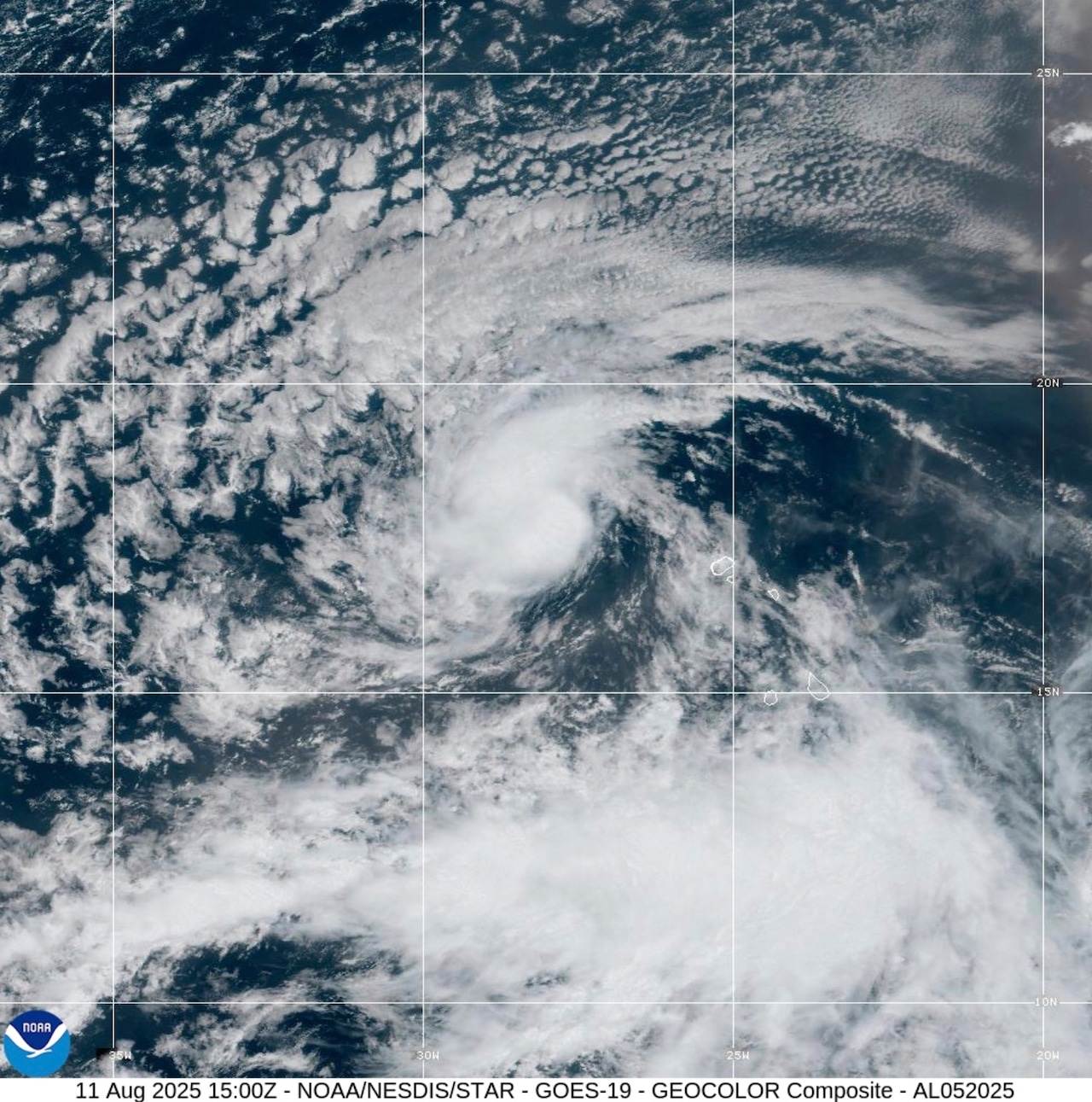
According to the hurricane center, Erin had maximum sustained winds of 45 mph (72 kph) by Monday afternoon and was roughly 430 miles (690 km) west-northwest of the Cabo Verde Islands. According to the report, Erin was traveling west at 20 mph (32 kph) and was predicted to stay on that general course for a few days.
Forecasters predicted that Erin might become a hurricane by the end of the week, with gradual strengthening expected over the next few days. As Erin approaches the northern Leeward Islands, the hurricane center said it is still too early to assess any potential effects.
In the central Pacific, Hurricane Henriette was a Category 1 storm on Monday. It was predicted to continue to be a hurricane for another day or two before waning. According to the NHC, Henriette’s highest sustained winds were 85 mph (140 kph). Approximately 595 miles (945 kilometers) northwest of Honolulu was where the storm was located.
Approximately 615 miles (990 kilometers) west of the southernmost point of Mexico’s Baja California peninsula, remnants of the former Tropical Storm Ivo disintegrated on Monday. The remains of Ivo are hardly a threat to land, according to forecasters.